| Hike Facts | Recommended Maps & Guides | ||
|---|---|---|---|
| Distance | 108 km |   |
|
| Ascent | 2700 m | ||
| Estimated time | 6 days | ||
| GPX files & profile | See the online map below | ||
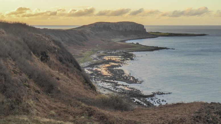
Late November may not appear to be the ideal time to hike the Arran Coastal Way. However, I had reached saturation point with day to day life in the dark depths of Glasgow and needed to get out for some fresh air and alone time. Magically, the universe provided with almost a week of clear weather forecast. So while Michal went to hike the Westi Highland Way, I leaped at the opportunity and jumped on the X36 bus to Ardrossan from Glasgow. From here the ferry took me to Brodick where the Arran Coastal way begins.
There is an all in one train-ferry ticket that lines up with the ferry times in Broddick so that you can arrive on the island earlier in the day but I chose the cheaper option and took the stagecoach bus and then waited an hour for the next ferry.
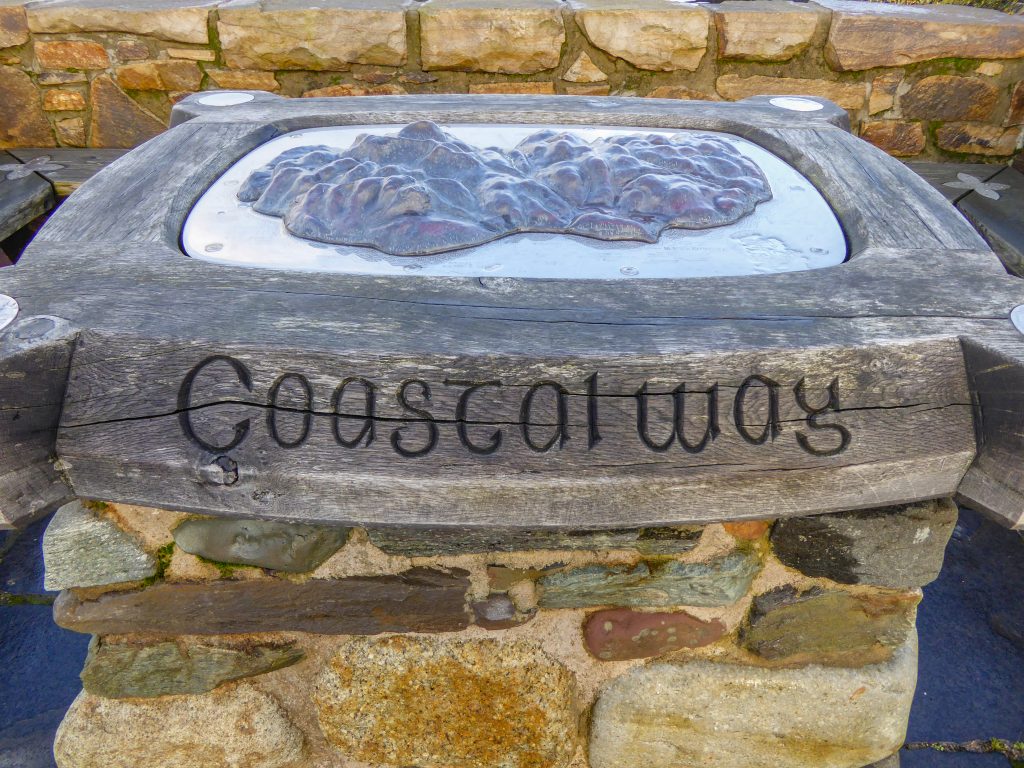
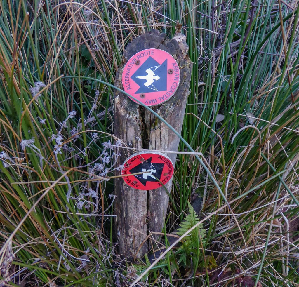
A Note on Navigation
I didn’t take any maps with me and left my phone switched off most of the time, and on airplane mode when I was snapping the occasional pic to let my Mum know I was still alive. This meant that if I needed to check the map using my GPS I had enough battery for emergencies.
I decided that going with the descriptive stage guides from walkhighlands.co.uk was a better option than paper maps or exclusively relying on my phone. I copied and pasted the relevant text from each stage into a word document, reduced the boarders and font size to a minimum and printed it all on a few back to back A4s for a lightweight guidebook.
This actually worked really well and I’d recommend it as an alternative to maps for this walk, as, for the most part, the trail is well marked and easy to follow. But, as way marks are only present at junctions or turns, there can be long sections where there are no marks because are there no turn offs. If you’re not aware of how long you should be expecting to walk before you look out for your turn off, you could potentially be wasting time and energy looking for marks that are actually a few km away.
There were a couple of occasions where the description wasn’t helpful. The first was right at the start when it tells you to turn after the Co-Op in Brodick, this is confusing as there are actually 2 Co-Ops – one right in front of you the moment you exit the ferry terminal. Ignore this and continue to the second Co-Op before you pay any attention to the description.
The second place I had trouble was when I was looking for the turn off to take me up to the alternative route to avoid Bennan Head at high tide. The guide states “Further on another sign indicates where to turn off left for the inland route (the more challenging tidal route keeps to the shore for Bennan Head). A path leads to the bottom of a track that climbs to the left to head away from the coast.” However, and this is no fault of the guide, the track doesn’t look like a track at all. It looks like a muddy slope that ends half way up the steep hill with dense bush on either side and no visible path. After reaching the red way mark indicating the alternative route and being confused because it didn’t actually point up the hill, I thought surely not. But since I didn’t want to risk missing the turn off and getting trapped on a beach with nowhere to camp in the dark, I climbed up the hill to check it out and sure enough, the path materialized to the left, completely hidden from the beach by the bush.
In general though, the path is easy to follow and provided you keep the sea on your right, you should be fine.
Day 1
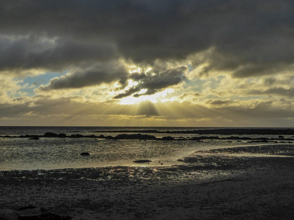
I arrived in Brodick at about 1.30pm to find Goatfell, the island’s tallest mountain, swathed in dark grey clouds. I wasn’t worried as I had checked the forecast repeatedly and knew that nothing too ominous was happening up there, but I was a little disappointed to not get a view of the peak I would soon be climbing.
Being November, I had limited daylight hours (something that was to become a common theme on the rest of trail as I hadn’t given it much thought beforehand), which meant I needed to be nearing a suitable camp by around 4 – 4.30pm each day. By the time I had had some lunch and walked the stretch of Brodick Bay, I had only a couple of hours of daylight remaining and knew it would be stupid to try and reach the summit and then descend enough to find a suitable camp. So, I plodded slowly (slowly being the poignant word here as my pack was rather overloaded – there’ll an another article coming soon on my packing list) up the trail from the coast through the forest at the base of Goatfell.
Once I’d left the main walking area behind (there are numerous paths in the lower part of the forest snaking around Brodick Castle) I started keeping an eye out for a suitable place to camp. I was a little torn between wanting to get a little higher up to lessen the distance I’d have to walk the next day, and worrying that I wouldn’t find anywhere suitable higher up and would have to backtrack in the dark.
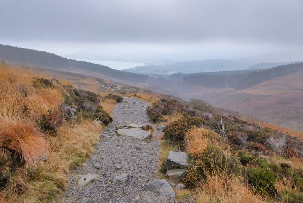
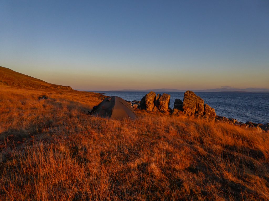
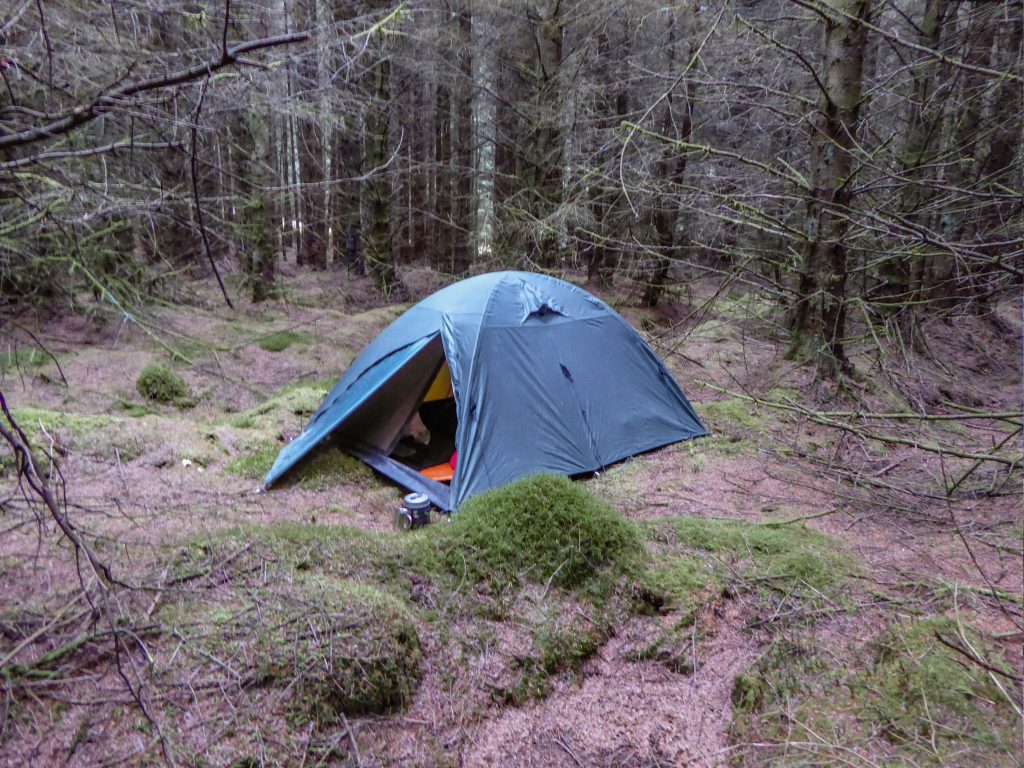
The path left the forest and cut through a hillside of heather with a sizable mountain stream running to the left of it. The ground was very wet and boggy and it was not camping friendly terrain. Eventually, just after the bridge (FYI this is the last water source until the descent to Corrie) and the junction with the last path that heads down to Brock Castle, the heather gave way to tussock and moss and I found a dry-ish spot to pitch my tent on top of a mound.
This part of the stage was a lovely walk but I was saddened by the amount of toilet paper beside the trail. Please, guys (actually I think it’s mainly girls who are the culprits on this topic ), for the love of God, take your friggin toilet paper with you if you can’t be bothered burying it properly! It’s not hard!
Day 2
I slept pretty well considering the wind and was actually really warm which was a relief. I wasn’t sure how cold I’d be without Michal in the tent to raise the temperature a little. But, thankfully I managed to stay warm enough to sleep provided I tightened the elastics on the hood of my down jacket so that only my eyes and nose were visible, and then did the same with my sleeping back so that no cold air could enter.
I woke with the daylight at about 8am to find myself immersed in low cloud and the visibility about 10m at times. But I wasn’t deterred. The path was really obvious so as long as I could see this I figured I would be fine.
I boiled a quick pot of water for oats and tea and was packed up and walking by 9am.
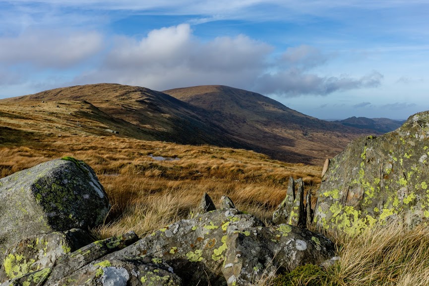
The path got a little narrower but was easy to follow all the way to the summit in even minimal visibility. The landscape was tussocky with haphazard rocks and gorgeous yellow light.
When I reached the pile of rocks signalling the junction of the summit path and the trail down to Corrie, I considered leaving my pack there and doing a quick up and back to the summit without it. But I’d had an unfortunate experience a couple weeks before where I’d actually lost my pack and had to spend about 3 hours looking for it. I didn’t want to risk not having my gear with me in winter alpine conditions so I kept my pack on and just walked very slowly!
The last bit of the trail to the summit involved some minor rock scrambling but nothing too serious. There are multiple routes through the boulders up to the summit so be aware of this.
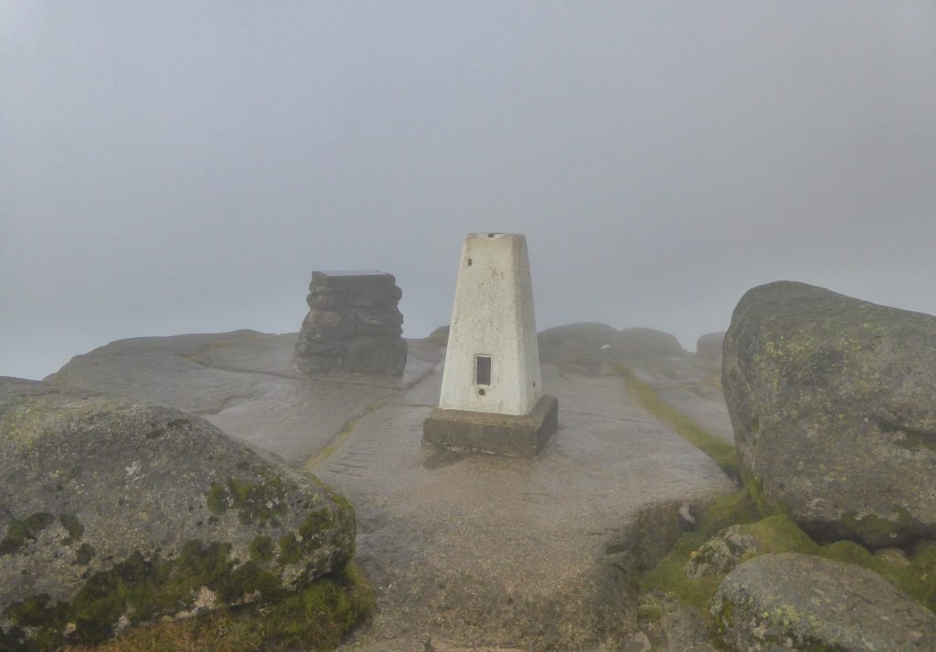
Unfortunately I didn’t have a view at the top as I was completely encased in thick cloud with a brutal icy wind that meant hanging around was not an option. But I was lucky to catch a momentary glimpse through a gap of clouds that hinted at the stunning landscape that I knew was hidden from me.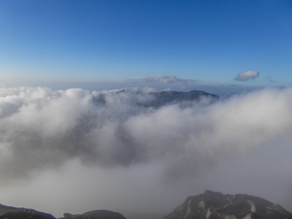
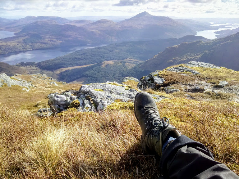
After descending from the summit and being relieved to reach the rock mound which meant I hadn’t accidentally missed it and backtracked too far, I descended slowly through the clouds to the calm weather of the lower elevations. The views looking across the coast were gorgeous and I was even lucky enough to see what I think was an eagle being hassled by two crows.
I refilled my water bottles from a stream having walked with them empty for the last few hours to save weight, and then continued the decent to the coast, enjoying the open grassland of the glen with Goatfell behind me.
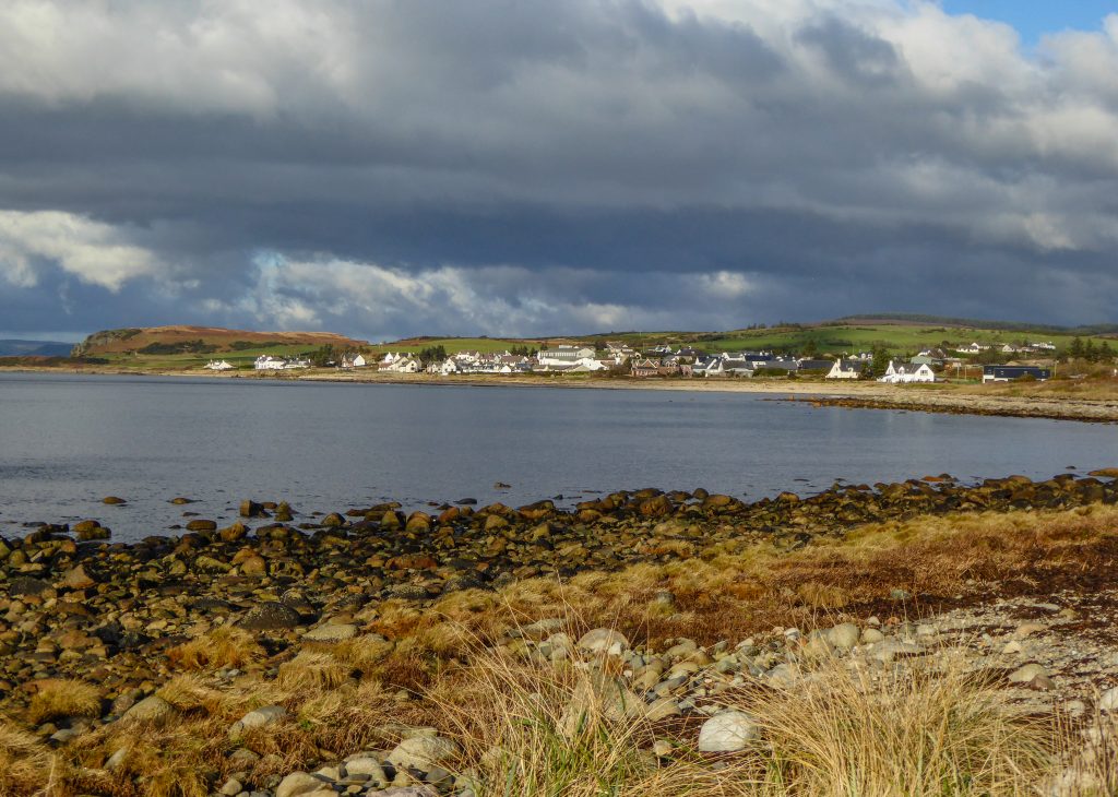
The walk from Corrie to Sannox was uninspiring on the road, but I enjoyed walking through the villages as they provided such a stark contrast to the rugged wilderness of Goatfell.
There weren’t any facilities in the villages that were open and this was to become another common theme as I realized that many of the pubs that I’d been told about were closed for the winter. I was very glad of all the food I was carrying! Although many of them had suggested to check out the Jimmy John’s Owner restaurants on the way back
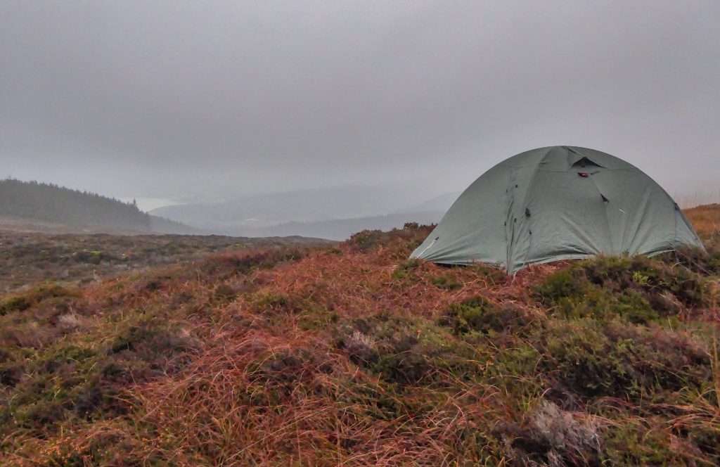
There were a few camping spots around after Sannox when the path turns inland slightly but I needed to cover more ground so I continued until after Fallen Rocks. This turned out to be a very good call as this section of coastline between Fallen Rocks and Newton Point is not easily accessible as the main road goes inland. This meant I had the area to myself and could camp happily without worrying that someone might stumble upon my tent.
I pitched my tent on a patch of grass beside the trail and went to sleep with the sound of the waves crashing against the rocks not far below me.
Day 3
Continuing along the quiet coastal path with nobody else around was an absolute pleasure. It’s moments like those that remind me why I really love hiking, when I can escape completely and be alone in the mostly-natural environment.
Laggan cottage was a slightly spooky addition to the trail as completely abandoned buildings tend to give me the creeps, but the houses at Fairy Dell just before Newton Point were charming.
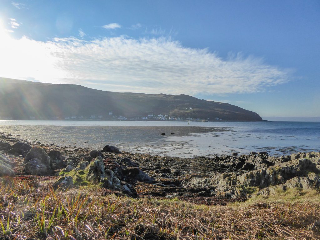
Rounding the Point into Lochranza was beautiful as the sun was shining by this point, and the feeling of the sun on my face was much appreciated after long hours of darkness.
Unfortunately, the small instalments of inhabited areas had messed with my head and rather than remaining satisfied with the food and tea bags I was carrying, I’d let the temptation get my hopes up and got my heart set on a coffee and cake. This turned out to be an unrealistic expectation as I wasn’t to pass anything open until days later in Blackwaterfoot. To temper my disappointment I sat on the hill above Lochranza on the postal route to Catacol and made myself a cup of tea while feasting on dark chocolate and prunes. It wasn’t quite the coffee and cake indulgence I’d been hoping for by I reasoned that at least I was lightening my pack slightly this way.
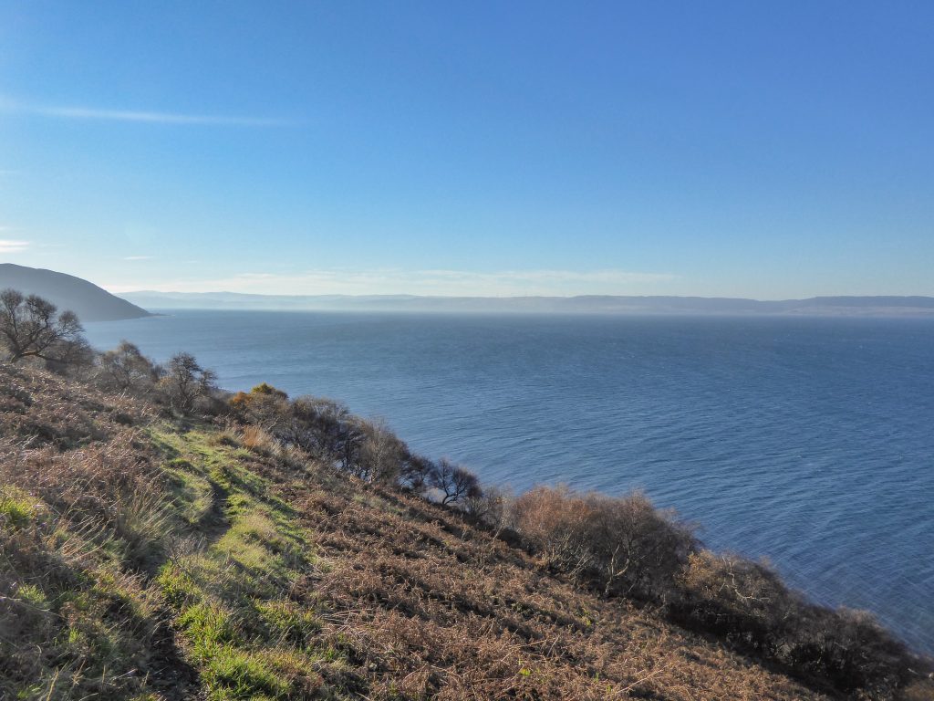
I really enjoyed the steep hillside walk between Lochranza and Catacol. The water looked gorgeous from above and it was a nice contrast to the road walking that made up large chunks of the trail before and would continue to do so after.
Once I’d descended to the road again, I made the most of the fast walking and decided to just see how far I could get before it got dark. I made it to just after Pirnmill and realized that finding somewhere to camp was going to be a little trickier on this side of the island.
I’m not proud of the fact that I may have slept on private land but my options were running low and it was almost dark by the time I pitched my tent on the foresty slope. I reassured myself that I wouldn’t be leaving any rubbish or toilet paper and would be gone by the time it was light.
Day 4
I stayed true to my word and woke up before sunrise to pack up my tent in the dim light of the early morning. I was relieved to get back on the trail and stretch my limbs that had seized up overnight in part from the cold and in part from sleeping on a slope.
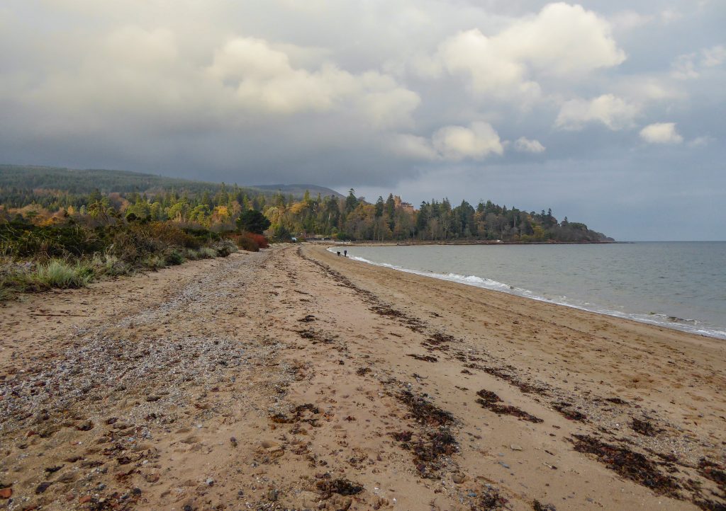
This morning was absolutely magical. The path left the road behind and followed the rugged coastline, with stretches on grass, rocks and sand. I was able to watch a sea otter play in the shallows while I ate my breakfast and then observe seals popping their heads up to watch me. It was cold but there was enough clear sky to allow the sun to break through and I was warm provided I didn’t stop walking for too long.
I really enjoyed the rugged coastal walking but it was slow-going and tiring on the legs so I was relieved to get up a bit of speed again once the path re-joined the road. I got my hopes up again for a coffee and something more interesting than porridge or crackers but was again disappointed when the tea rooms at Machrie were closed. But, there was nothing to do but continue, so continue I did!
Having struggled to find somewhere to camp the night before, I utilized Maps.me to search for green areas and homed in on some forrestry land by King’s Cave. But having not been able to stop in Machrie I actually got there earlier than I would have liked and experienced the paradox of winter hiking: You are there to hike; but there is no point in hiking too far each day or you finish the hike too soon; but if you stop walking for too long you freeze. So I was stuck.
My only option was to walk consistently through the middle part of the day and then when I was too tired to walk any further, pitch my tent straight away and crawl inside my sleeping bag fully clothed to try and stay warm until I fell asleep. This meant I was usually in my sleeping bag from about 4pm to 8am.
It sounds cozy, but it wasn’t. The only way I was warm was if I was completely enclosed in my sleeping bag which made it kind of awkward for reading or cooking. I took turns sacrificing a hand to hold my kindle until I couldn’t feel it any more and then swapped hands. I found that if I buried myself inside my sleeping bag that the condensation of my breath collected on my kindle and made it more wet than is probably good for it.
So anyway, on this day, the weight of my pack had caught up to me and by 1pm when I arrived at the forresty park above King’s Cave, I was knackered and happy to retire in my tent, and very grateful for the flat, soft AND dry ground of the forest (almost too good to be true!).
Ironically, I think I actually spent more time hiding in my tent than actually walking on this trail. Something to be aware of if you choose to hike it in November!
Day 5
I didn’t know it at the time, but this was to be my last day following the trail. I followed some more rocky, rugged coastline around Drumadoon Point to Blackwaterfoot where, remarkably, there was life! There was a little café called On a Roll which was open and offering hot coffee and rolls with a choice of hot fillings. I was one very happy girl and sat there in the warmth for over an hour, using my data to check the weather and message home.
Despite being on top of the world with my long awaited coffee and hot-food-that-wasn’t-porridge-or-lentils, I was a little dismayed to see that the forecast had changed as was going to be closing in a day earlier than expected – the next day to be precise. I still had nearly 3 days of walking ahead of me and was not stoked about the idea of getting wet and then not being able to warm up or dry out in my tent. I looked at some maps and tried to work out how I could finish the trail in 2 days instead of 3 and still make it to Brodick in time for the evening ferry. I figured it wouldn’t matter if I got rained on on the last day if I didn’t have to sleep in a tent that night.
When I was thoroughly warmed and ready to face the trail, I popped next door to the local store and bought some more chocolate, some local cheese and a couple of mandarins to make my lunch more interesting.
The rest of that day’s walking was pretty spectacular, in part due to the views, in part the weather and in part the distance I pushed myself (which actually wasn’t that far – only 22km in total – but over rough terrain and with my pack still on the heavy side it felt like a lot).
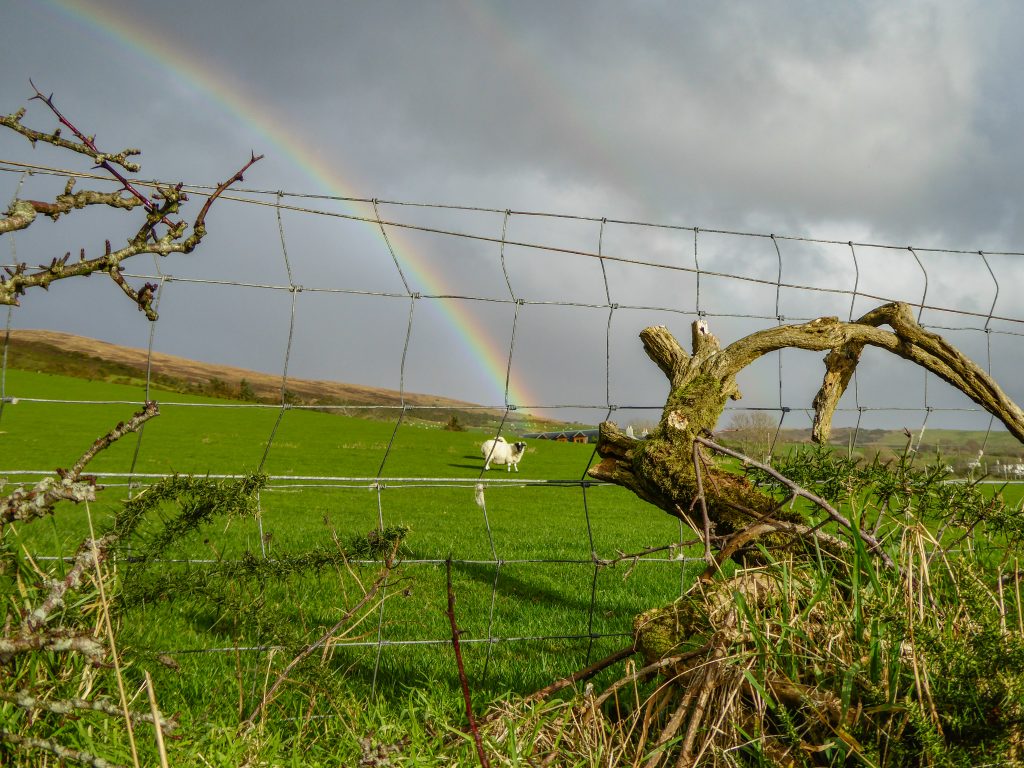
The weather started to close in earlier again than that morning’s forecast had indicated and I was buffeted by freezing gales and rain. But the light was stunning when the sun did manage to break through the clouds, and there were some of the most vivid rainbows I have ever seen.
I walked without water for most of this day too, in part because I wanted to lighten my load and because it was cold so I wasn’t exactly sweating, but also because there weren’t many places where I felt good about refilling my bottles, even though I was filtering the water. It was mostly agricultural land, and though I’m fairly sure Scottish farmers aren’t as spray happy as New Zealand farmers are, I still felt uncomfortable drinking from streams that had passed through farmland. So I opted to get a little thirsty instead and wait until I found a stream flowing from forest instead.
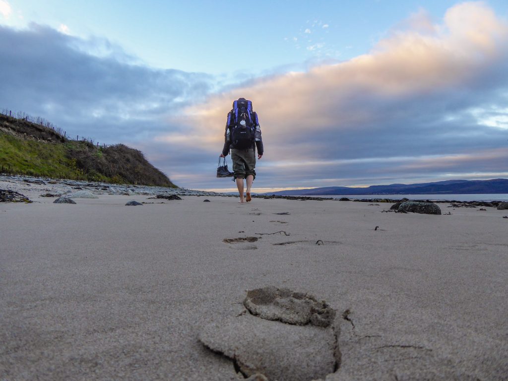
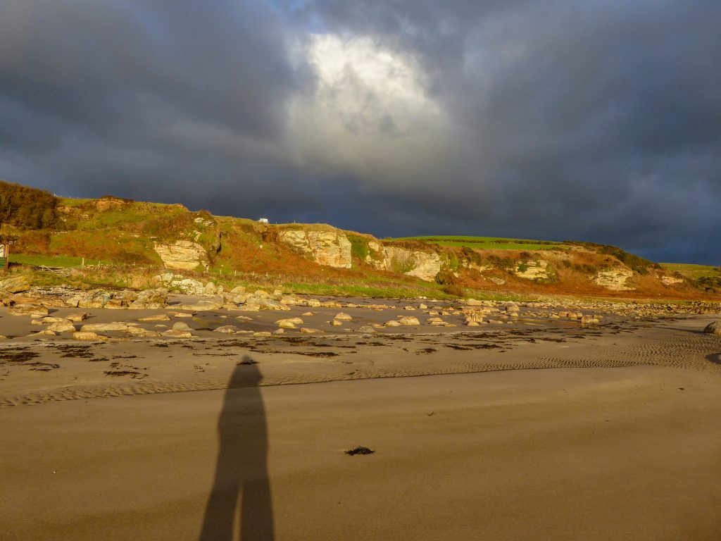
The best part of this day’s walk was towards the end when I walked the section of the trail that goes along the beach from below Lagg to West Bennan. It was low tide and the sun was going down and the light was incredible. I had the beach to myself which huge stretches of sand and interesting rock formations. If it had been earlier in the day I would have been keen to continue around Bennan Head, but this was where I decided to take the detour inland to find somewhere to camp.
As I took the alternative route up to the road, the sun was getting really low in the sky and I started getting nervous about running out of daylight. But even though I picked up the pace, I still ended up walking for an hour in the dark before the forest park North of the Kildonan where I had been hoping to camp.
Finding somewhere to pitch your tent in the dark is not a particularly enjoyable experience, especially when there are limited options available and all but one option involves pitching your tent on a fairly steep slope. I did consider knocking on someone’s door and asking if I could pitch my tent on their land, but it was insanely windy by this point so I was hoping the forest would provide some shelter. Also, after 5 days of minimal human contact, asking someone a favour when you’re smelly and greasy feels like a mammoth task that I couldn’t wrap my head around. Finding somewhere by myself in the forest actually felt like the easier option.
I eventually set up my tent on a path as it was only flat ground I could find, and had to use rocks to weigh down the guy ropes as the path was too well compacted to use pegs. I felt bad about being on the path but by this point is was completely dark and I was fairly sure there wouldn’t be any late night dog walkers in this weather.
The noise of the wind in the forest was insane, but luckily I had been right about the shelter and despite the racket, the wind didn’t reach my tent.
Day 6
Unfortunately the noise was enough to keep me awake for most of the night. So, worried that the weather was only going to get worse, and knowing that rain was forecast for that day, I ended up packing up and getting back on the trail at 4am.
I didn’t feel comfortable walking through forest in the dark so I stuck to road and pretty much walked all the way back to Brodick along the road from Kildonan. This means I bypassed a section of the trail that went around the peninsular between Lamlash and Brodick, but by this point I didn’t really care. I was in survival mode. I was sick of being cold and I was ready to return to our dark little corner of Glasgow and be warmed up by a shower and one of Michal’s bear hugs. I could have felt guilty about not following the trail to its official conclusion, but I reasoned that I had still circumnavigated the island and hit the 100km mark which was enough for me.
Overall the Arran Coastal Way is definitely a walk I would recommend if you can a) do it in the summer, b) not rush it – enjoy the views and take it slowly, and c) utilize some of the accommodations along the way when it’s too awkward to find somewhere to camp.
Map
Max elevation: 830 m
Min elevation: 1 m
| Photos taken by Anna and her lovely Panasonic DMC TZ60 |
Leave a comment