| Hike Facts | Recommended Maps & Guides | ||
|---|---|---|---|
| Distance | 153 km |  |
 |
| Ascent | 4340 m | ||
| Estimated time | 5 days | ||
| GPX files & profile | See the online map below | ||
Walking the West Highland Way in November was quite a spontaneous decision, mostly based on a small window of good weather. I’d been in Scotland for a few months and hadn’t seen such a steady forecast lasting 4-5 days. It occurred to me that I could walk the West Highland Way in 5 days in that amount of time and decided it was too good an opportunity to pass up. Anna decided to go for the Arran Coastal Way as we sometimes like to go for our own hikes rather than to do everything together.
If you want to know more about the WHW, check my other article about West Highland Way FAQ.
1st Day: Milngavie – Balmaha
I started the hike in Milngavie on Friday at midday, planning on being finished by Tuesday night.
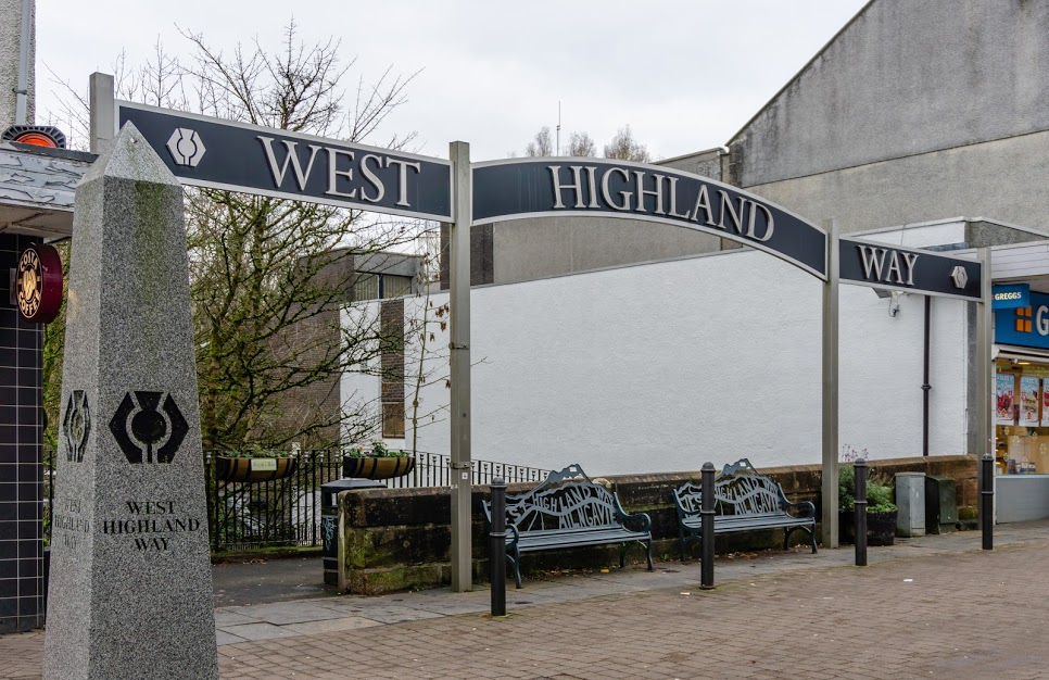
The signs pointing to the West Highland Way started directly from the train station. A couple of minutes later, I saw the extravagant gate marking the start of the West Highland Way. It was that moment I realized that this was going to be a Camino de Santiago-like experience, marked from the start until the end. This was good though, at least I didn’t have to think about navigation. Like, at all. Shinny marks were present at all crossings, all the way to the square in Fort William where the trails ends.
The first section of the trail to Drymen alternated between tracks, village roads and walking paths. It was nice but nothing you couldn’t find anywhere else around the UK. I reached Drymen in about 5 hours and the sun was due to set in an hour so I sped up as I wanted to reach Conic Hill before finding somewhere to camp.
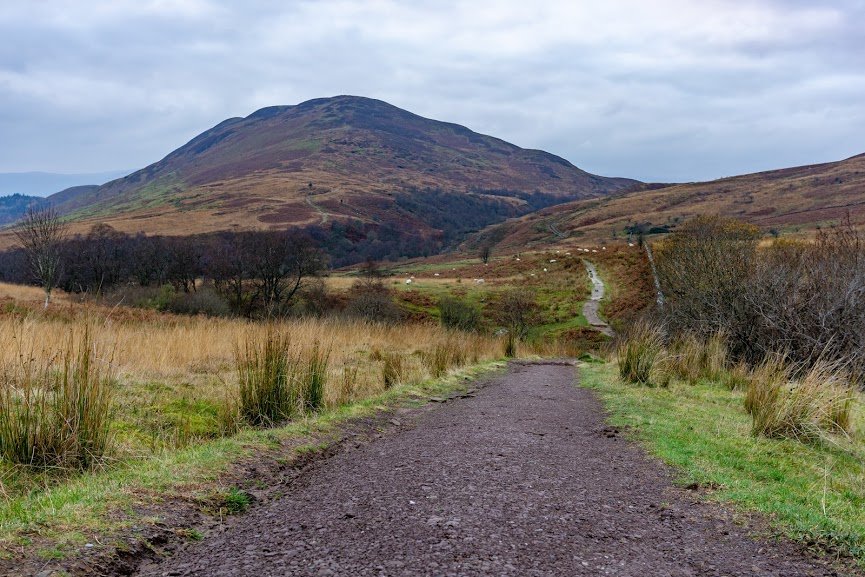
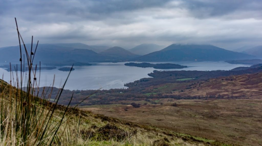
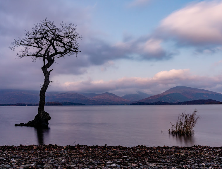
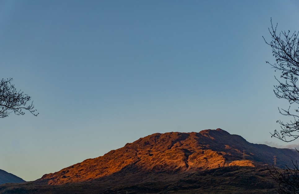
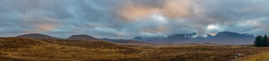
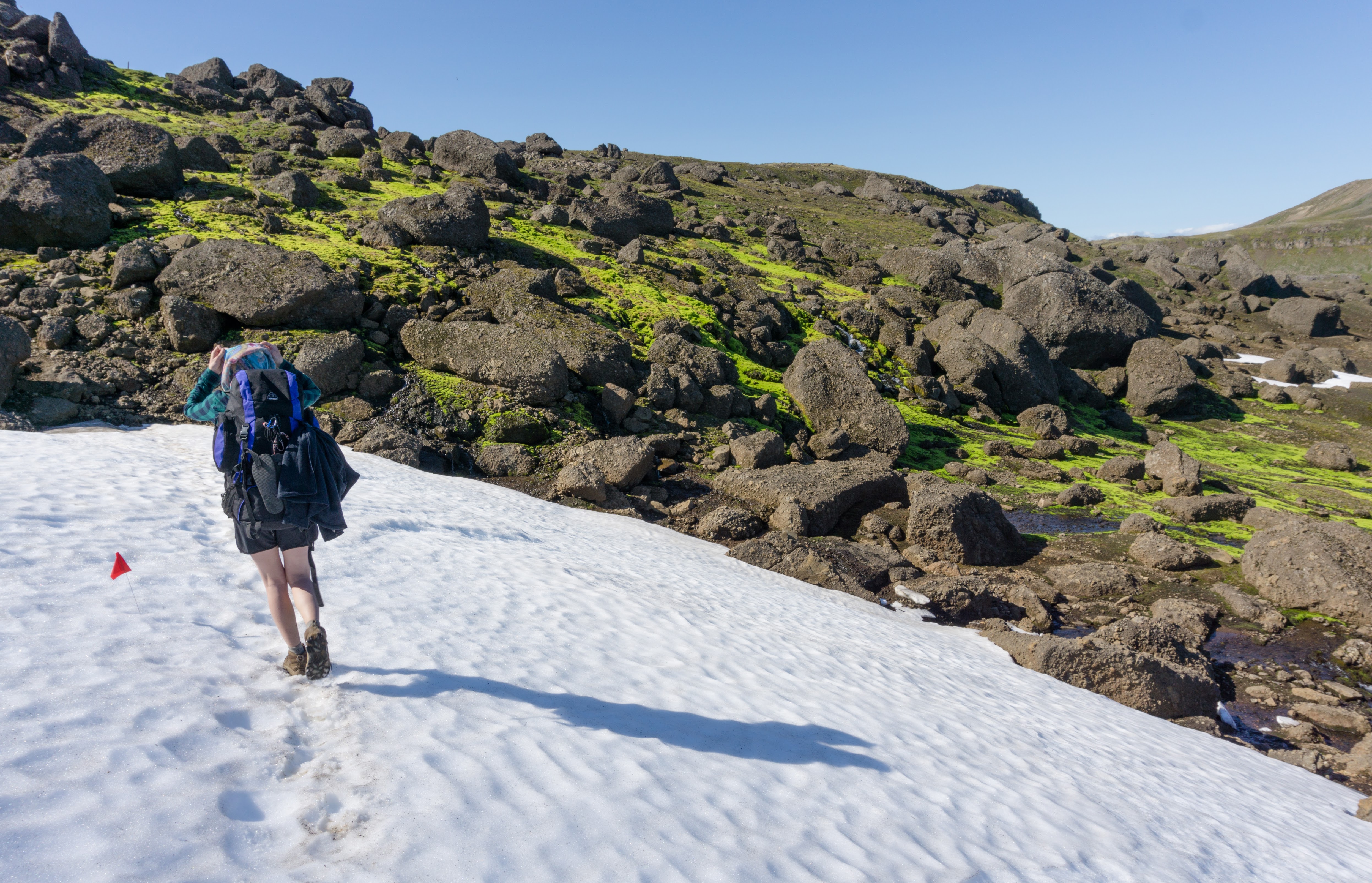
The forecast was promising a clear night with a gentle breeze. I reached Conic Hill just as it was getting dark, so I decided to pitch my tent right there so I could have a view over Loch Lomond.
A few hours later, when the 40 mph wind was pulling my tent pegs out, I spoke words that would have made my colourful-mouthed Grandma proud. With the wind came a big heavy cloud that sat itself on top of the mountain. The cloud was so thick that I saw pieces of it in my tent.
Even though I felt like I was sleeping on a busy construction site above a guy with a jackhammer, I managed to fall asleep somehow, regularly waking up to fix my tent. When it was 5 AM, I decided that it had to end. It was still pitch dark but I packed my stuff and down the mountain I went.
2nd Day: Balmaha – Bothy Doune Byre
As soon as I arrived at the forest on the mountainside, the wind disappeared and I was immersed in silence. I even considered re-pitching my tent and going back to sleep, but then decided I couldn’t be bothered.
I kept going down to the village of Balmaha. There, at 6AM, the Christmas decorations on the main street seemed like a dream. Just an hour before I’d been fighting the elements, but in Balmaha everything was in its place. It was surreal.
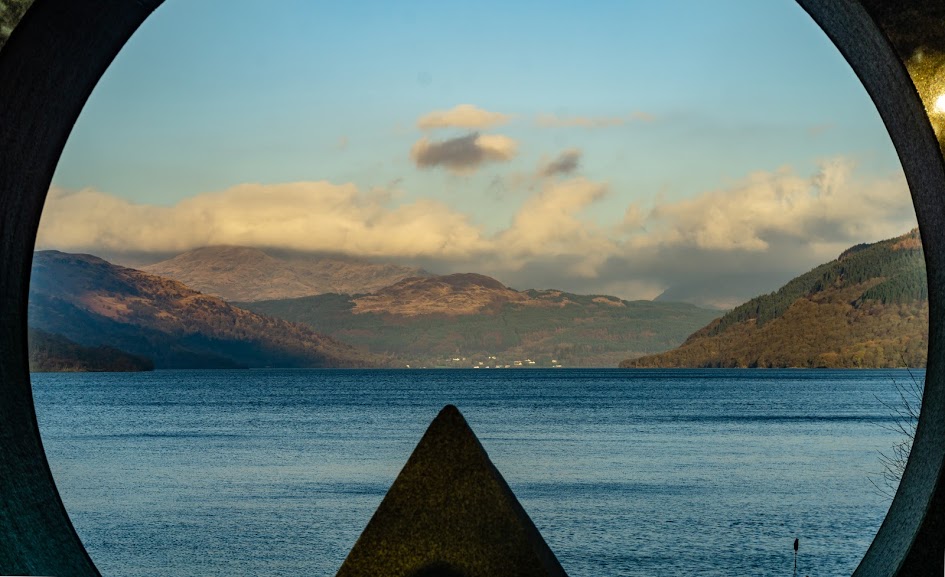
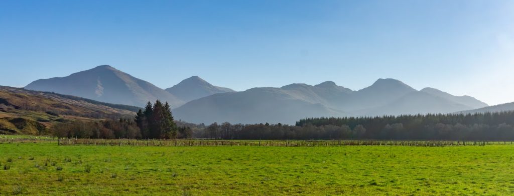
I path from here strolled along Loch Lomond with big sections on the main road. But it was still very nice, especially with the early morning sun on my back. The sun was igniting all possible shades of brown and yellow in the tired leafs. Rainbows were popping out of the rocky mountain tops covered in pink-tinged clouds. And I was strolling. Magic.
When I reached Rowardennan, the path left the road behind and turned into a regular track. Finally! I was flying over the trail, with nothing on my mind and with the Scottish sun hanging low and checking in on me. This part is often referred to as the hardest part of the trail technically. And on a scale of the other sections of WHW it probably was. But on a scale of Scottish hikes in general it was probably more like 4/10. It’s up and down quite a bit but never too much up or down that you’d have to stop to let your lungs to catch up.
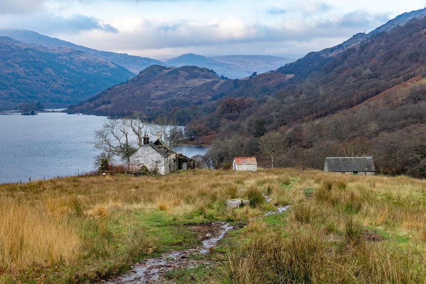
I passed Rowchoish bothy. The lazy part of my brain was tempted to stay, arguing that I hadn’t had much rest the night before night. But the hiking part won, arguing that the day was so sunny and nice that it was worth continuing.
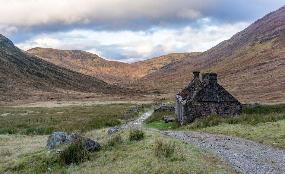
3 hours later, I arrived to Doune Byre bothy. It was incredibly nice. The bothy was sitting silently above an estuary. Next to the bothy there were ruins of an old farm house, a small stream was running just a few metres from the entrance and bats were circulating around its roof. A bit spooky but I since I turned 28, I’m not afraid of spooky places anymore. I definitely recommend staying there. May Buddha bless Scotland and their bothies and the kind folk who maintain them.
3rd Day: Bothy Doune Byre – Bridge of Orchy
When I woke up, the stars were still shining. The only way you can beat the shortage of daylight in winter is to simply ignore it. So, I put on my head torch and hit the trail before 6AM.

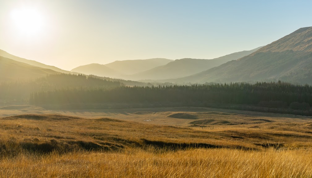
The path was nice but monotonous, just following a noisy highway through a wide, open valley. I mean glen. Glen glen glen. No valleys in Scotland, only glens.
Waiting for the sun seemed to take forever. It only stays very low on the horizon and with big mountains, it doesn’t even hit the bottoms of some glens at this time of the year. Also, it doesn’t provide any warmth until 11AM, about 3 hours after sunrise. Waiting for a bit of warmth seemed to take a long time every morning.
After Inverarnan the path started to head more into the hillsides and the views went nuts. In a good way of course. In particular, the part around Hill Farm was magnificent. Yes, I could imagine being a farmer there! Oh wait, the sign said it rains 3 times more than in Edinburgh with an annual rainfall of 2.5m… Maybe not.
The next town, Tyndrum, turned out to have the best facilities out of all the towns on the trail. There was even a reasonably big grocery store which I attacked on an empty stomach. I bet you can’t guess what happened. Yes, I bought too much food. I always forget this basic rule of life: don’t open a bottle of wine when thirsty, don’t go shopping when hungry. You either end up drunk in 5 minutes or with a week’s worth of groceries that you can’t carry. Not sure what’s better. Anyway, “too much food” turned out to be just enough in the end. Never underestimate how much your appetite can grow when you’re hiking.
Decently resupplied I started heading toward the village, Bridge of Orchy. This part is an easy stroll along the base of the magnificent Beinn Dorain. The mountain looks so symmetrical from the south! Like a Scottish version of Mt Taranaki or Mt Fuji. Hopefully I’ll climb it one day.
I reached the Bridge of Orchy just before darkness settled on the hills. I found myself a cozy spot in a nearby forest and continued on with my reading of The Master and Margarita. A brilliant book at the end of a brilliant day!
4th Day: Bridge of Orchy – Kinlochleven
I woke up at 4AM to a freezing night. It sounds early but it’s really not if you’ve spent the last 12 hours in your sleeping bag. Technically it might have already been morning but the line gets blurry when there are billions of stars in the sky. I wasn’t brave enough to get out of my sleeping bag straight away but after some hot tea I managed. The ground was frozen. No wonder my feet had been cold at night.
15 minutes later I was flying over the trail. It doesn’t sound fun but it is my favorite way to start the day.
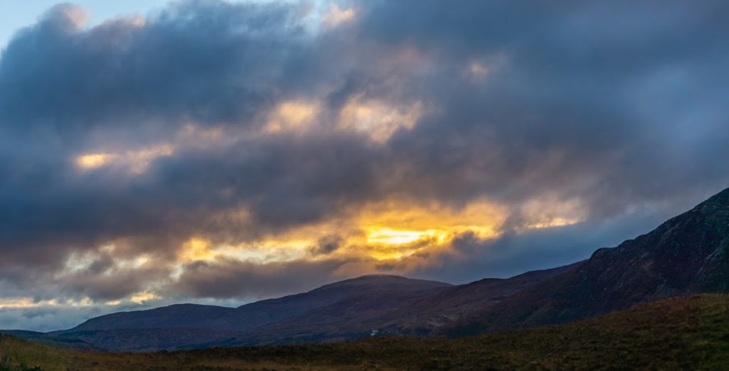
The morning was magnificent. Scary looking dark clouds were fighting with their pinkish sisters on a background of yellow sky and silently watching mountains.
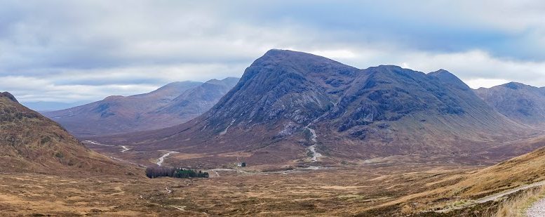
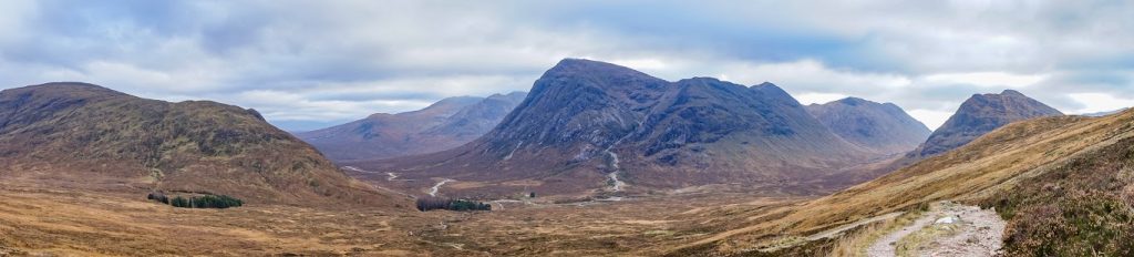
I passed a lonely hotel in Inveroran and soon hit the old road that goes across Glen Coe. This is often referred to as the part of West Highland Way with the best views and there is a good reason for it. Even though I had a cloudy day, it was truly stunning. I felt so small in the vastness of the the glen and its towering mountains.
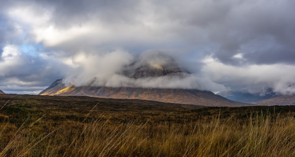
On the top of the ridge of Glen Coe I hit a cloud and met my first hikers in four days. The warned me that the Devil’s Staircase (the next ridge on my way) looked close but was actually really far. Ya ya, sure sure. I descended to the glen, leaving Glen Coe behind.
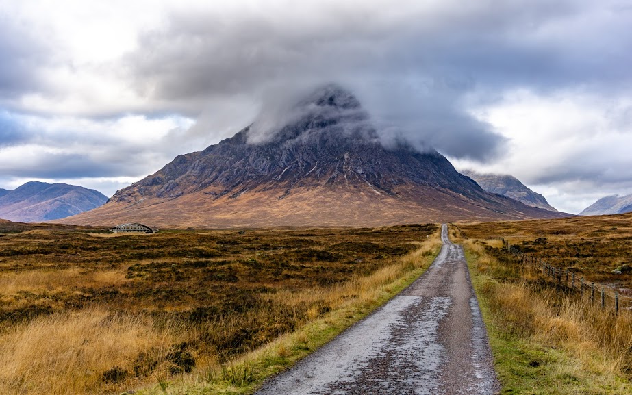
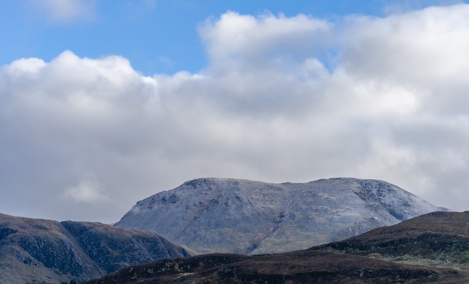
I could kind of see where Devil’s Staircase was. I was following a small road but the Devil’s Staircase didn’t seem to get any closer. Man, it was far! I figured that in the multiple-mile-wide glen things appeared smaller and closer that they really were. It’s also mentally demanding to keep moving your legs but not to really feel like you’re getting any closer. Luckily Stob Dearg, another stunning Munro, was keeping me entertained. With the constantly changing clouds and light, watching a cloudy peak is the best form of entertainment for a hiker.
I finally got to the car park below the Devil’s Staircase after 2 hours. I was kind of knackered and in need of a fuel boost. The car park was full of campervans with people inside, watching me while I tried to fight the wind and boil some couscous. I must have looked ridiculous because the wind was blowing from all possible sides and my stove wasn’t liking it at all.
Finally, with a full belly, I was keen to find out if there were any devils up on the Devil’s Staircase. It took me about half an hour to conclude that no, there weren’t any. The views were very good though.
The descending path to Kinlochleven is tricky. On your right side, you can see Blackwater Resevoir where the water to Kinlochleven Hydro Plant is coming from. So, you might logically think that it’s close. But, keep in mind that there is about a 8 km conduit heading to the plant. So, what does the logic say now? Yes, it’s almost a 8 km descent to Kinlochleven. It’s a great section of trail though with lots of scary looking Munros ahead. It’s hard to believe they’re “only” about a km high, they look much bigger to me!
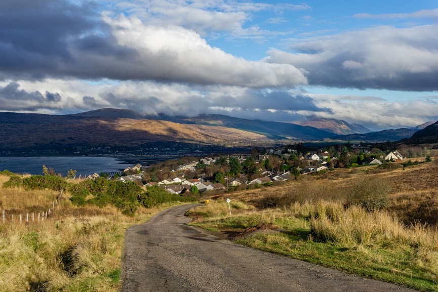
Kinlochleven is a descent sized town and has everything you might need. When I reached it, I was tired enough to not need anything and I pitched my tent in a birch forest, just a couple of hundred meters behind the town.
5th Day: Kinlochleven – Fort William
On the last day of my journey, I allowed myself to sleep until 8am. Yes, all the way to 8! There was no rush, my train was departing Fort William at 8 pm. Above all, I knew that the last section was only 25 km on a nice trail serving also as a cycle path. And if a cyclist could go there, it couldn’t be hard. Like every morning so far, the light plays were magical.
The path was steep at first but soon became gentle, wandering through a long glen. Occasional farm ruins spiced up the journey well. I admire anyone who moved up here in the past and tried to make a living by farming.
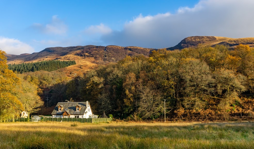
Two thirds of the way into the last section I came to a crossroad saying that the rest of the trail was closed. Bummer! The logging works were due to last until the spring. I was advised to take a diversion route but it was actually not bad at all! I got to see some new farm houses and how modern Scottish farmers live these days.
When I first saw Ben Nevis, my knees started trembling. I know it sounds silly but for a hiker these moments are very special. Ben Nevis carries the title of being the UK’s highest mountain so it was hard to not be a little in awe of it.
Two hours later it was over. I stood in the square in Fort William, thinking “Hum, so that was it I guess”. No hard feelings this time. No sudden waves of satisfaction like when I finished the PPT, no surprised observations as to how “developed” areas looked like when I finished the GR132. I was just there and it was over. Where can I find a cafe to crash in for 8 hours?
Fort William
It was an excellent hike though, really great. I’d honestly recommend it to everyone who feels the calling of the Scottish mountains and doesn’t have the time or skills to do something more intense like the Cape Wrath Trail. I’d also recommend to do it off season as there are as much as 36 thousands hikers doing the trail and it can turn into quite crowded experience. As I met only two other hikers (!) I had the trail for myself pretty much all the time.
Map
Max elevation: 549 m
Min elevation: 8 m
| Photos taken by me and my lovely Sony a6000 |
Nice post, especially the lovely photos. I too walked the WHW in November and it was a great time to go, hardly any people.
Anyway, surely when you say Devil’s Ridge you mean Devil’s Staircase?
Hi Duncan, I’m glad you like it! Yes, I meant Devil’s Staircase 🙂 Thanks for pointing that out, it’s been fixed. All the best