| Walk Facts | Good book about tramping in New Zealand | |
|---|---|---|
| Distance | 16 km |  |
| Ascent | ~1600 m | |
| Estimated time | 9 hours | |
| Hiked on | 3th August 2020 | |
| Map & GPX files | See the online map below (with GPX download) Open the track at NZ Topo Maps |
|
| Participants | Heidi Barlow & me | More books about tramping in New Zealand |
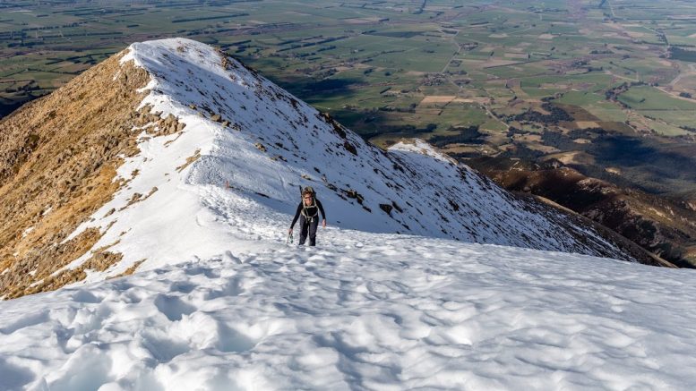
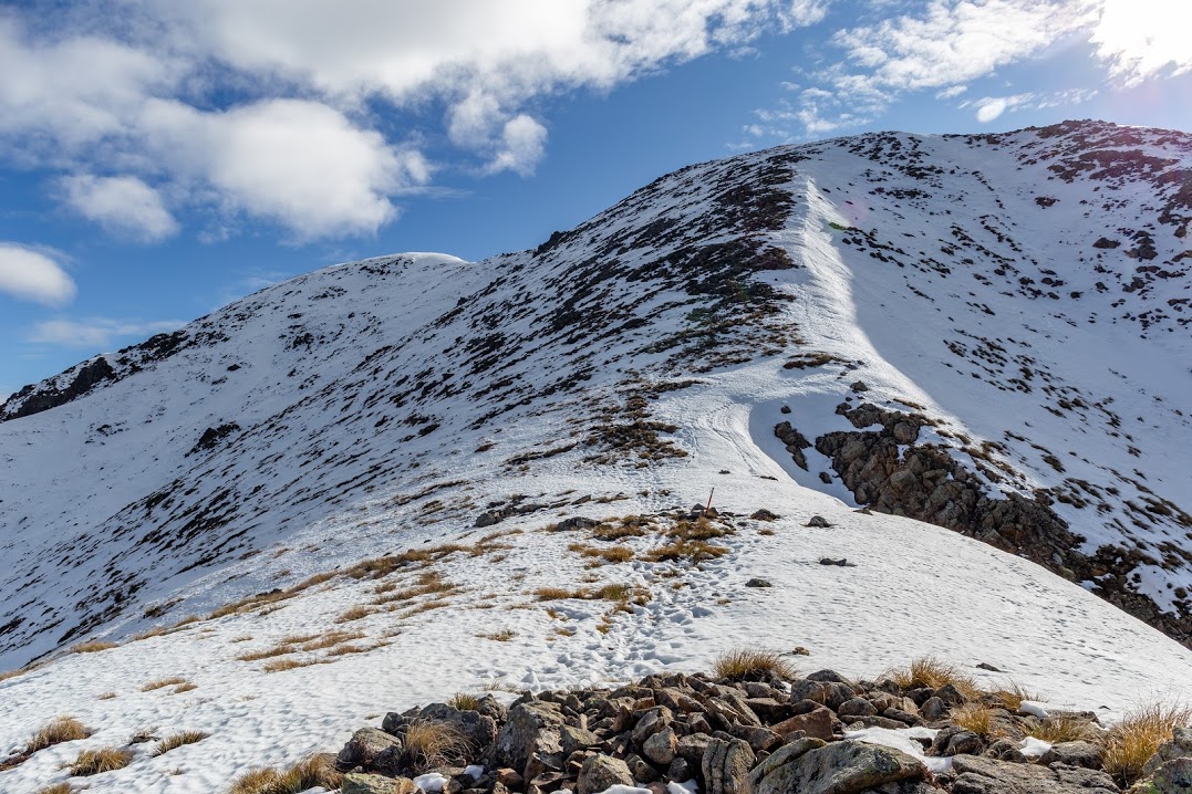
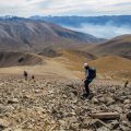
As I don’t work Mondays, I decided to organize some Monday trips. The first one was to Mt Somers with only one brave participant, Heidi. We started off at Sharplin Falls Reserve and followed a well marked trail to the start of Mt Somers Summit Track. From there, a steep section of unstable rocks followed. At about 1400m we encountered knee deep snow which was too soft for crampons so we continued with our boots on to the ridgeline. At the ridge, more snow was encountered but was so soft that sometimes my whole leg would disappear. Despite me going first and showing Heide where all the crevices are, she managed to find quite a few on her own.
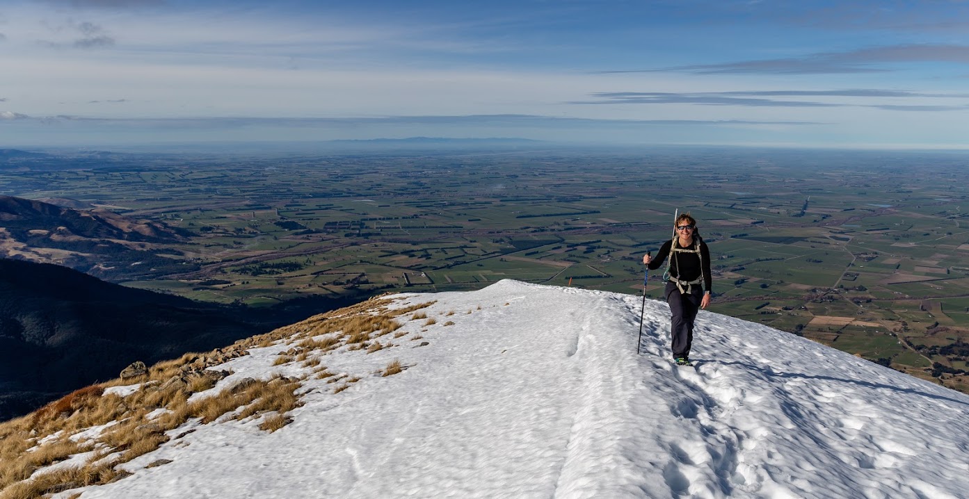
We had a decent break on the top. I presented my co-tramper with two options: going back the same way in order to reach the car reasonably tired but before dark, or go via the saddle between Pinnacles Hut and Woolshed Creek hut and to reach the car in the dark and in a likely exhausted state. After a tiny bit of hesitation, Heidi opted in for the second option. If we’d known that there was about 2 kms of deep snow ahead, we might have chosen otherwise. Mt Somers is quite flat on the top and there was quite a bit of soft snow which provided us with a lot of ’entertainment’. The travel was slow and exhausting. After a couple of hours we finally started our descent to the saddle.
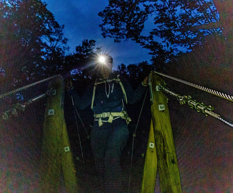
Once we reached the track, we travelled fast again. We arrived at Pinnacles Hut just before dark and met a teenage girl from Dunedin who said she’d slept at Pinchgut Hut the previous night – a pretty impressive job to walk out of Pinchgut Hut, drive 3 hours to Mt Somers and walk up here! We left her at Pinnacles Hut and off we went back to Sharplin Falls carpark. The last two hours of the tramp were with headlamps in complete darkness – what a fun way to finish the first tramping Monday!


Map
Max elevation: 1688 m
Min elevation: 441 m


Be the first to comment on "Mt Somers Loop Track via Pinnacles Hut"