| Walk facts | Good book about the trail | |
|---|---|---|
| → Distance / ↑ Ascent | → 47 km / ↑ 3 km |  |
| Time | 3-4 days | |
| Map | See the online map below See also the official trail map in PDF |
|
| Hiking report | Here | |
The Juan de Fuca (JDF) trail is one of 3 classic, long coastal trails on Vancouver Island (the others being the West Coast Trail and the North Coast Trail). Unlike the other 2 trails, neither campsites or transport need to be booked in advance on the JDF. Furthermore, from what I’ve heard, all 3 hikes offer a similar experience. So, for me, the JDF was number 1 on my list for hiking on Vancouver Island.
Trail overview
The trail is 47 km long and usually takes 3-5 days to finish and can be hiked in either direction. We did it in about 3 days which felt perfect for us, but most hikers we met took 4-5 days to hike it. The hike can be divided into the following sections (at the end of each section you can find a campsite):
| Route | Distance | Estimated time |
| Juan de Fuca Trailhead – Mystic Beach | 2 km | 40 minutes |
| Mystic Beach – Bear Beach | 7 km | 3 hours |
| Bear Beach – Chin Beach | 12 km | 5 hours |
| Chin Beach – Sombrio Beach | 6 km | 3 hours |
| Sombrio Beach – Little Kuitshe Beach | 6 km | 3 hours |
| Little Kuitche Beach – Payzant Campsite | 7 km | 2 hours |
| Payzant Campsite – Botanical Beach Trailhead | 7 km | 3 hours |
Sleeping
There are lots of campsites you can stay in and the fee is $10 per night. You don’t have to book them in advance, they work on first come first served basis. The fee is payable via BC Parks website or by cash at the main trailheads. We saw the self-reservation boxes with envelopes at China Beach Car Park, Parkinson Creek Car Park, and Botanical Beach Car Park.

Campsite self-reservation box is only available at the main trailheads
I recommend aiming to reach your campsite early (by mid-afternoon) as they can get quite full. When sleeping at beach campsites, watch for washed up seaweed and never pitch your tent between the seaweed and the ocean unless you want to practise night swimming in a sleeping bag.
Mystic Beach Campsite is nice and close to the car park with lots of spots on stones and only a few on the sand. Bear and Chin beach are similar with many nice spots above the beach line at the edge of the forest. Lots of them have fire pits. Sombrio beach is the busiest campsite on the trail as is easily accessible by a car. But because it’s so big, there’ll usually be a private and quiet spot for you if you search enough. There used to be a community on the beach and there is a movie about it.
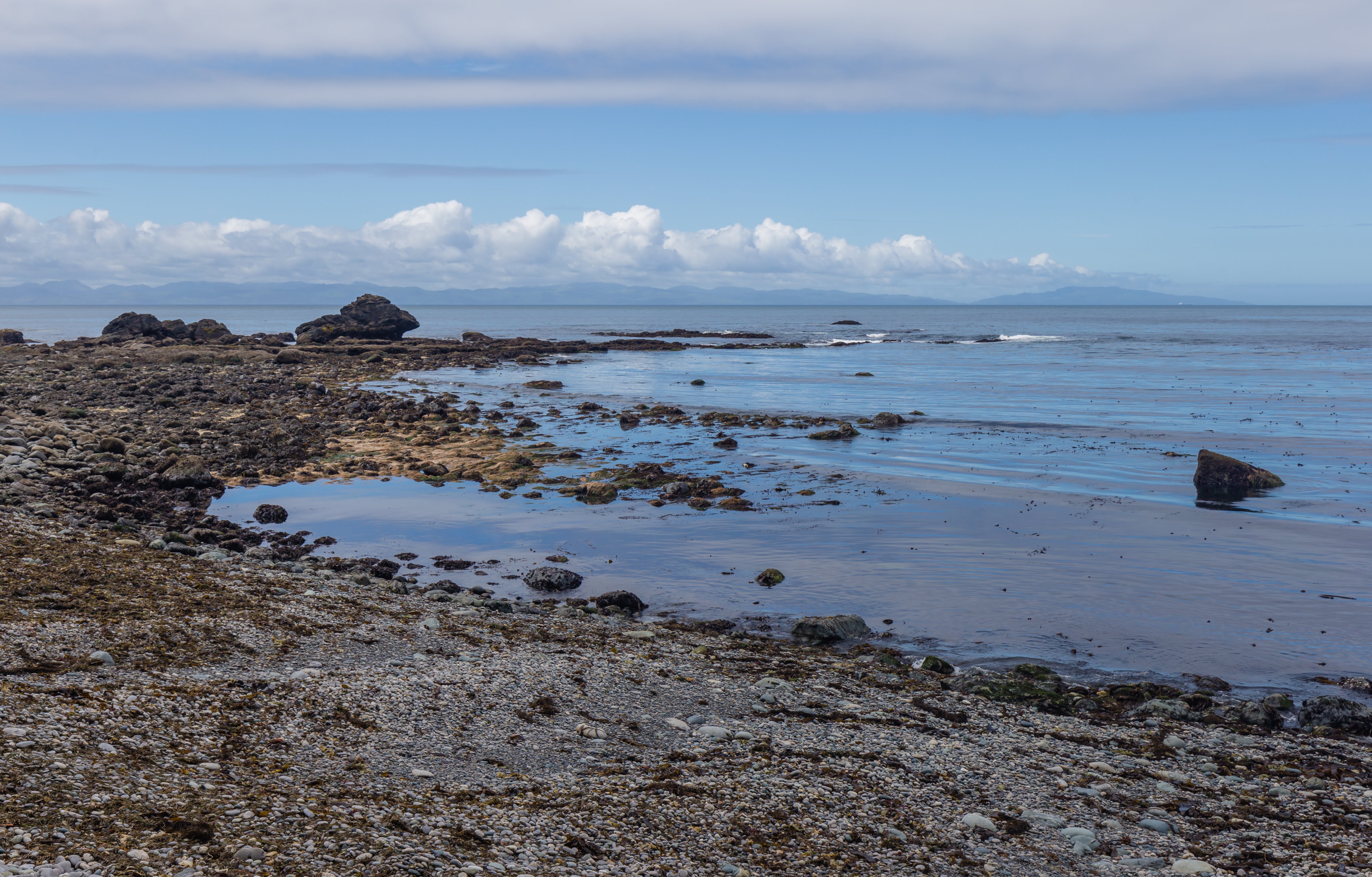
You definitely want to hang out at Sombrio Beach
Little Kuitche and Payzant Campsites are the forest campsites. Little Kuitche is nicer in my opinion and there is an easy access to the rocky beach where you can enjoy some sun.
If you’re sensitive to noise, take ear plugs because the waves can get really noisy at night. At Mystic Beach in particular, high tide was around 2am which brought the waves rushing up the stones to within 2 meters of our tent and the noise was incredible.
Getting in & out
There is a bus connection to trailheads provided by West Coast Trail Express. It can take you to China Beach trailhead or Port Renfrew from where is it about 2 km walking to Botanical Beach trailhead. It’s quite pricey but that’s your only option if you don’t have a car.
You can try to hitchhike too although this is officially illegal. We managed to get a ride from Port Renfrew to Victoria quite easily but we were prepared to catch an evening bus if we didn’t get a ride. The bus should be booked in advance, especially during the high season (summer weekends).
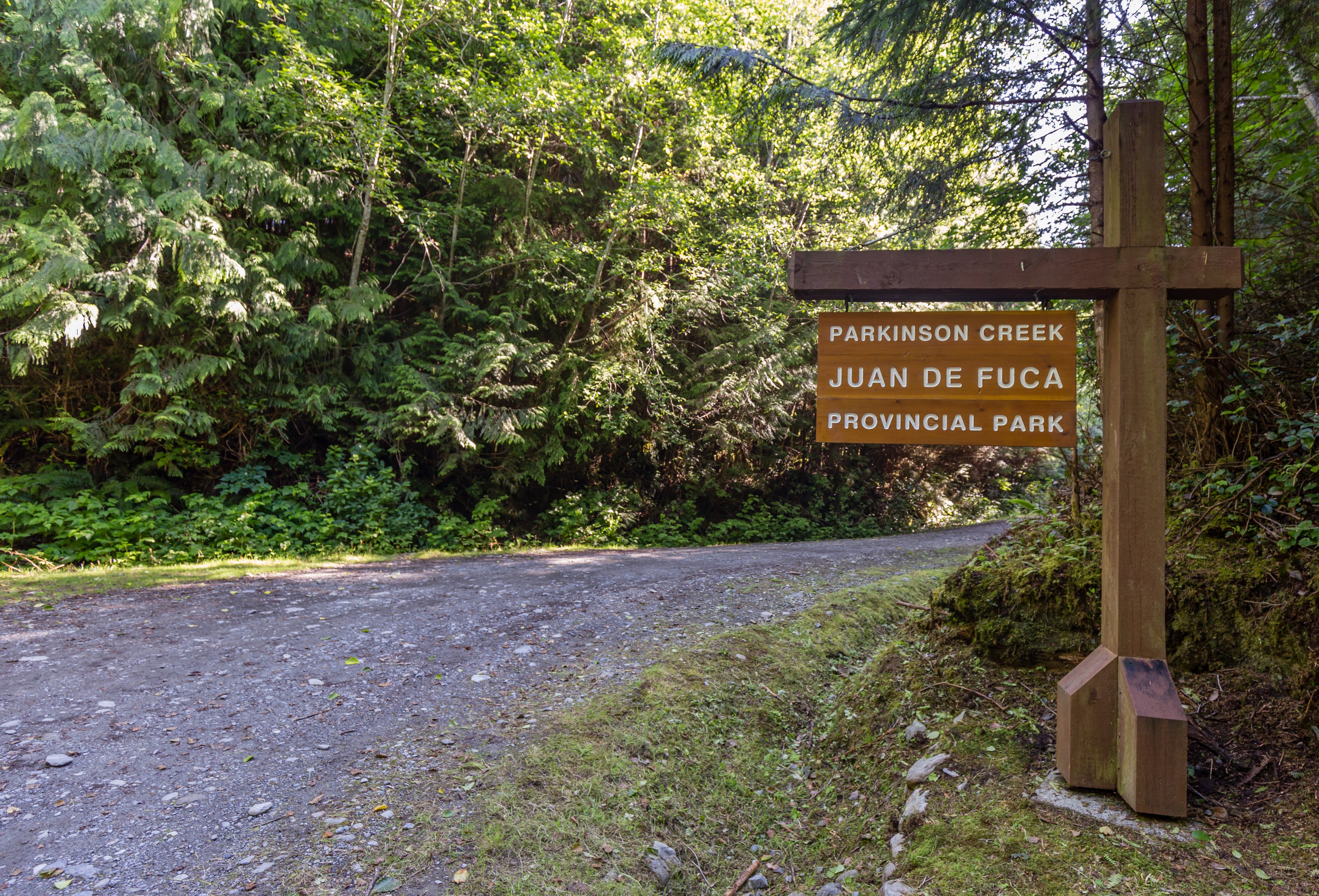
Parkinson Creek Trailhead
Besides the main two trailheads, it’s possible to access the trail from different places too. Great access for day hikers is at Sombrio Beach where the car park is only about 300m from the beach. If I was to recommend a day hike along the trail, I’d go for a section between Sombrio Beach and Parkinson Creek Trailhead. It’s relatively easy and there is a long section which you can do along the beach – just watch out for orange buoys hanging from the trees which mark the enter/exit points from the beaches.
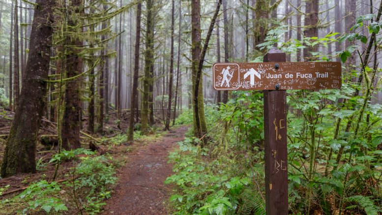
Navigation
There are only occasional marks and signposts on the trail. Even though most of the time the trail is easy to follow, I wouldn’t go out there without a good map or GPS. There are many side trails and the terrain is challenging so you don’t want to get lost!.
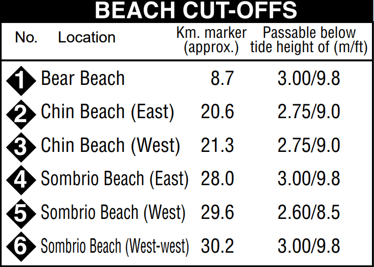
It’s very important to watch out for tides. Bear Beach, Chin Beach and Sombrio Beach are impassable during high tides. This period is usually quite short (just a couple of hours or so), but it can be longer if the wind brings big waves. Basically, go to Tidal Predictions for Port Renfrew and compare the chart at the bottom with the following picture:
Food & water
There aren’t any opportunities to resupply on the trail. You have to carry all the food you’ll need (and a little spare for emergencies). There is plenty of water though, I was pretty much alright carrying 700ml water bottle and I’d refill it as I needed from the ample streams along the way.
The official advice is to treat or filter the water before using. I didn’t treat it most of the time and I survived. Anna chose to treat her as she’s had bad luck in the past with catching stuff from water. Just use common sense.
My impression
The trail is challenging, short, muddy, and with many ups and downs, but exceptional. I’m a bit biased because of my love of coastal trails but I’m sure that even a non-biased hiker would enjoy it. It is very muddy though. We had rain for half of the time but I heard that it’s muddy even when there hasn’t been raining for weeks. The forest there is deep and can keep the moisture in for a long time. I’ve summed everything up in the hiking report.
Map
The official sources say that the hike is 47 km long. I think that’s more accurate than what my GPS file says which came out at about 41km. (GPS is never very accurate when it comes to hikes with lots of ups and down in a short distance.)
Max elevation: 166 m
Min elevation: -0 m
Is the trail open? Planning on hiking it southbound on May 9/2021. Heard rumours it may be closed?
Not sure, sorry, better to check with local authorities
I’m also planning on hiking southbound on May 8, 2021. I saw some closures on this site (https://bcparks.ca/explore/parkpgs/juan_de_fuca/) but not too sure what they mean.
It the trail hike-able now?
I don’t know John, sorry
Hi Michal,
1. What is the best time to hike this trail, weatherwise? Our plan is to do it in September.
2. From Renfrew Port’s tidal chart, I notice, 9am onwards , we get an hour of 1 m or less tide . Based on the campsites’ locations, we hv to plan our day.
3. Did u face too much of rain ? When we did the Nootka Trail, day 1 was horrible, but thereafter we had wonderful weather.
Cheers
1) I think autumn or spring would be nice, athough in spring in may be a bit rainy. September would be perfect
2) Not sure
3) Yes, we had some rain but we’re used to it. There is no bad weather, only bad clothes!
Michal, are there a lot of people on the trail and at night ? What about wild animals ?
No there aren’t any people on the trail at night. Wild animals at night? A lot of them prefer to move at night so yes, there would be wild animals at night like black bears
Thanks for the information was curious, would you recommend the trail for younger children
Hi Holly, what do you mean by younger children? The beach parts are flat and easy but the parts that go through the forest are quite steep and muddy at places. I’d recommend it for kids 12+ unless your kids are used to this kind of terrain and don’t mind mud and ocassional scrable
Thanks Michal.planning to hike this trail this summer. Appreciate you sharing your knowledge. Cheers.
My pleasure Steve. It’s a great hike so I’m sure that you’ll love it 🙂
Thanks for the great tips for this trail!
My pleasure. Enjoy the trail!