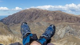
Christmas party with Mr 1 year in Kelly Range
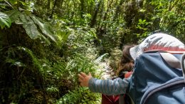
On 24th December, Anna, our 1 year old son and myself decided to escape the Christmas fuzz and we headed up to Kelly Range in Arthur’s Pass Area (technicall the West Coat).Anna was carrying the…
On 24th December, Anna, our 1 year old son and myself decided to escape the Christmas fuzz and we headed up to Kelly Range in Arthur’s Pass Area (technicall the West Coat).Anna was carrying the…
This was a super last-minute trip. It was actually so last-minute that it can’t get any more last-minute. I and Kupic were basically texting about if and where to go AND quickly packing at the…
What can I say about this trip: There are heaps of glowworms on the way to Cedar Flat Hut which can be a magnificent experience if you decide to hike at night as we did. The tracks around Cedar Flat are in TOP condition. Incredibly well marked and cut thanks to volunteers from Permolat.
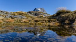
Going to Black Hill Range wasn’t our first choice for this weekend. We reaaally wanted to go to the West Coast but the weather was so bad that weekend that we couldn’t do anything else but stay on the Canterbury Plains. So, we decided to do the Comnys Hut – Cookies Hut traverse via the North Branch Ashburton River / Hakatere.
Mt Sommers Track is one of the most popular overnight hikes for Christchurchians. Fair enough, it’s close to Christchurch and it’s pretty nice there. As the track doesn’t go too high up, I made up my own variation of the track with ascending Mt Sommers and Mt Winterslow which are the highest mountains in the area. Alright, I didn’t actually stand on the top of them but I was just an easy stroll away.
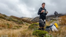
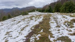
Being back in New Zealand after nearly 3 years of nomadic across a couple of continents meant one thing for me: I was ready for a hike. It was the end of March and the first morning frosts had begun to appear across the South Island.
When the three of us stopped to take our 101st break of the day, desperate to get a few drops of water from our near empty bottles, I gazed over towards the northeast and there lied this giant mass of rocky earth. “That’s Girdlestone,” I murmured almost silently, partly because I had little energy left, partly as I knew clearly my friends had this same voice in their mind: “last big climb!”
The Cathar Way is a roughly 240 km hike in the south of France, one of my favourite places in the world. It follows the historical sites of the Cathars through the Eastern foothills of the Pyrenees, passing through villages with stone houses often at least a few centuries old.
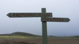
A lot of words have been written about the Laugavegur Trail. It’s a regular member of top-ten-hikes-in-the-world articles. Because of that, I’ll limit myself to just some tips which could be helpful for fellow hikers.