Summer hikes

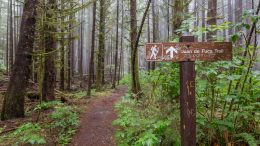
Juan de Fuca Trail: Essential Information

The Juan de Fuca (JDF) trail is one of 3 classic, long coastal trails on Vancouver Island (the others being the West Coast Trail and the North Coast Trail). Unlike the other 2 trails, neither campsites or transport need to be booked in advance on the JDF. Furthermore, from what I’ve heard, all 3 hikes offer similar experience. So, for me the JDF was number 1 on my list for hiking on Vancouver Island.


Off Track in New Zealand: Jumbo, Broken Axe Pinnacles and Mitre in the Tararua Range

When the three of us stopped to take our 101st break of the day, desperate to get a few drops of water from our near empty bottles, I gazed over towards the northeast and there lied this giant mass of rocky earth. “That’s Girdlestone,” I murmured almost silently, partly because I had little energy left, partly as I knew clearly my friends had this same voice in their mind: “last big climb!”


On the Upplandsleden Trail from Knutby to Gimo

After seeing the lovely Norra Lunsens and walking a few kilometres along the Upplandsleden Trail, I decided to give this long distance hike a try for a bit longer. Upplandsleden is about 448km long and winds alongside Uppsala, the capital of Uppsala County in southern Sweden.


Exploring hiking trails in Norra Lunsens

Norra Lunsens is a nature reserve south of Uppsala, Sweden. It’s easily accessible by public transport (eg. bus stop Fjällfinas Kåta) and kind of a must for every hiker visiting the city.


Reykjavegur, stage 6: Djúpavatn – Grindavík

The shortest stage of the trail is still very dry and volcanic but gets a bit busier thanks to a nearby main road. At the end of the stage it’s possible to make a detour to the famous hot pools, Blue Lagoon, or the city of Grindavík with a supermarket. There isn’t any water on the trail itself. Very vaguely marked.


Reykjavegur, stage 5: Djúpavatn – Brattháls

The fifth stage starts by crossing a colorful volcanic range. An easy grassy part is followed by an extensive mossy lava field. Only vaguely marked overall, and the initial range not marked at all(!). There are tiny streams in the grassy part but no water at the end(!).


Reykjavegur, stage 4: Kaldársel – Djúpavatn

First part is forested but after the quarry it gets volcanic again. Marking is sometimes confusing, especially around the quarry. Water only at the start (a small river flowing out of the reservoir) and the end (a tiny stream going to the lake Djúpavatn).


Reykjavegur, stage 2: Múlasel – Bláfjallaskáli

Rough from the start, flat and industrial in the middle with a long gradual ascent and sharp descent at the end. Some parts are vaguely marked or not at all. There isn’t any water between the Exhibition centre in Hellisheiði and the ski resort in Bláfjallaskáli.